Buying a home is exciting, but it can also feel overwhelming. Between the lender paperwork, inspections, and title searches, you’re asked to order something called a mortgage survey. At first, it seems like this quick sketch of your property is all you need. But here’s the truth many new homeowners discover too late: a mortgage survey is made for the bank, not for you. And when it comes to protecting your investment, it often falls short.
What Exactly Is a Mortgage Survey?
A mortgage survey, sometimes called a loan closing survey, is a basic drawing of a property. The lender uses it to confirm that the house sits within the lot lines and that no major violations are obvious. Think of it as a quick glance rather than a deep investigation.
The bank’s main goal is to reduce risk on its loan. As long as the house isn’t hanging off the lot or built halfway into the neighbor’s yard, the mortgage survey does its job for the lender.
But here’s the catch: this sketch rarely includes detailed boundary research, easements, or local setback rules. It’s not built to protect you if you want to build a fence, add an extension, or fight a neighbor’s encroachment claim.
The Reddit Frustration: “I Thought My Survey Covered That!”
If you’ve spent time on Reddit in the last week, you’ve probably seen threads filled with frustration about mortgage surveys. Homeowners vent about ordering a survey for their closing, only to learn later that it doesn’t hold up for permits or disputes.
One common story goes like this: A new owner hires a contractor to build a deck. The town asks for a certified boundary survey to prove setbacks are met. The homeowner waves their mortgage survey, thinking it’s enough. The town says no, and the project stalls. The owner ends up paying for another survey—delaying construction and doubling costs.
These posts are painful to read, but they highlight a truth every buyer needs to understand: not all surveys are the same, and using the wrong one can set you back months.
How Mortgage Surveys Compare to Other Surveys
To clear up the confusion, let’s look at how a mortgage survey stacks up against other common types:
- Boundary Survey: This defines the exact property lines and corners. A licensed land surveyor researches deeds, maps, and records, then places stakes on the ground. If you want to install a fence, this is the survey you need.
- ALTA Land Title Survey: This is the most detailed option, often required in commercial deals. It maps boundaries, easements, rights-of-way, and improvements, and checks zoning compliance. If you’re investing in a large property or working with complex titles, an ALTA survey is worth the cost.
- Topographic Survey: This survey shows the natural and man-made features of the land, like slopes, trees, and driveways. Engineers and architects rely on it for site design and grading.
Now compare these to a mortgage survey. You’ll notice how limited the mortgage version is. It’s the bare minimum for the bank, while the other surveys actually protect you.
Why York Closings Are Especially Risky
York isn’t just another town in Maine—it has specific rules that make mortgage surveys even less reliable.
- Shoreland Setbacks: Properties near tidal waters, rivers, or wetlands face 75-foot and 100-foot setback rules. A mortgage survey usually won’t flag these restrictions. You might buy a lot thinking you can add a shed, only to discover later that it’s illegal.
- Hidden Easements: Many older neighborhoods in York include utility or drainage easements that aren’t obvious. These can block you from building in part of your yard. Mortgage surveys often skip over easement research, leaving you exposed.
- Flood Risk: FEMA flood zones along the York River and coast can require an elevation certificate before you build. Again, a mortgage survey won’t prepare you for this.
These local factors mean that what looks like a simple closing can quickly turn complicated if you rely only on the bank’s sketch.
A Real Example
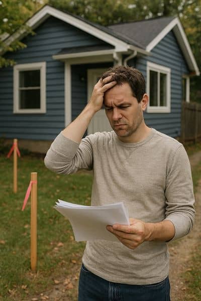
Picture this: A couple buys a cottage near Long Sands Beach. Their mortgage survey shows a neat rectangle with the house sitting comfortably inside the lot. Six months later, they decided to build a sunroom. When they apply for a permit, the town asks for proof of setbacks. The couple hands over the mortgage survey. Denied.
They call a licensed surveyor, who performs a proper boundary survey. The result? The neighbor’s fence is two feet inside their lot, and part of the sunroom design crosses into the 100-foot shoreland setback. Now the couple faces a boundary dispute and has to redesign their addition—delaying construction by an entire season.
If they had ordered a boundary or ALTA Land Title Survey at closing, these issues would have surfaced early, saving time, money, and stress.
How to Protect Yourself
The lesson is simple: don’t let the bank’s minimum be your maximum. When you work with a licensed surveyor, you have access to land survey solutions that go far beyond a quick mortgage sketch.
If you’re buying residential property, a boundary survey gives you confidence about lot lines. For commercial or high-value properties, an ALTA Land Title Survey is the better choice. It’s the gold standard, covering easements, zoning, and other details that protect your investment.
Think long-term. Even if you don’t have immediate building plans, choosing the right survey today can save you from setbacks tomorrow. A mortgage survey is fast and cheap, but it leaves too much uncovered. Spending a little more for detailed survey work is an investment in peace of mind.
Final Thoughts
Closing on a home is a big milestone. But don’t make the mistake of trusting a mortgage survey to do more than it was designed for. It might satisfy your lender, but it won’t protect you from disputes, setbacks, or hidden restrictions.
If you want to move into your new home with confidence, talk to a licensed land surveyor about the right survey for your situation. Whether it’s a boundary survey for your backyard fence or an ALTA Land Title Survey for a commercial deal, the right choice now will save you costly surprises later.


