Lidar Mapping Helps You Catch Drainage Issues Early
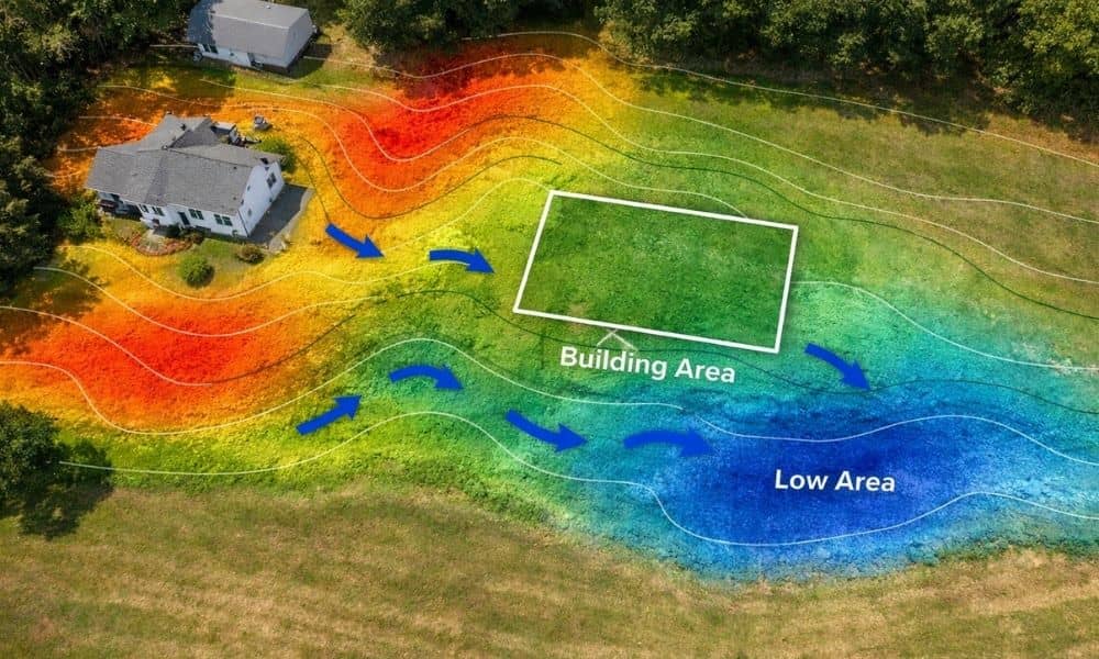
Planning a building project sounds simple at first. You pick a design, choose a spot, and send plans in for approval. Then delays hit. The town flags drainage issues. The layout sits too close to a setback line. Now you revise everything. This happens more than people expect in York, Maine. A lot of sites […]