Land surveying is something most people don’t think about until they need it. But if you own property in York, a survey can save you from legal headaches, neighbor disputes, or costly construction mistakes. Surveys give you a clear picture of your land, so you know exactly where your boundaries lie.
1. What Land Surveying Really Is
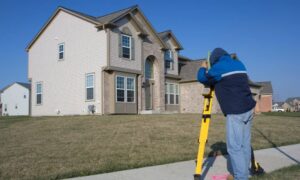
Land surveying is the process of measuring and mapping land. A surveyor uses specialized tools to find the exact property lines, shapes, and features of a lot. In York, where properties often include stone walls, old landmarks, and scenic coastal edges, surveys help clear up confusion. A survey shows exactly where your land begins and ends so you don’t have to guess.
2. Why Land Surveys Are Essential Before Buying Property
Picture this: you buy a home near the water in York and later find out part of your driveway crosses into your neighbor’s lot. That small mistake could cost you thousands of dollars. Land surveying prevents this by revealing the true boundaries before you sign the deal. Lenders also often require surveys for mortgages, but even if they don’t, it’s smart protection. When you buy land, a survey confirms you’re getting what you paid for.
3. Different Types of Land Surveys You Should Know
Not every survey serves the same purpose. Here are the main types York property owners might need:
- Boundary Survey – Determines the exact property lines.
- Topographic Survey – Maps features like trees, slopes, and water. Many York property owners rely on topographic survey services when planning a new build on uneven ground, since these surveys show how the land’s natural shape will affect grading, drainage, and foundation work.
- ALTA/NSPS Survey – Common for commercial properties.
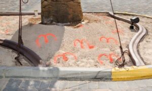
- Construction Staking Survey – Guides builders on where to place foundations, roads, or utilities.
Choosing the right survey depends on what you’re planning. A boundary survey might be enough for a fence, but if you’re building a home on a hillside or near the coast, a topographic survey gives you a clearer picture of the challenges you’ll face.
4. The Role of Land Surveying in Property Disputes
York is one of the oldest towns in Maine, and many properties here have long histories. That means disputes over fences, driveways, or trees are not unusual. When disagreements happen, a land survey provides legal clarity. Courts recognize surveys as proof, so having one can quickly settle arguments and save you the stress of drawn-out conflicts.
5. How Much Land Surveying Costs (and Factors That Affect It)
The cost of land surveying in York varies. A simple residential boundary survey might cost a few hundred dollars, while larger or complex projects can run higher. Factors include:
- The size of your property
- Terrain and landscape (coastal land can be tricky)
- The type of survey you need
- How easy it is to access old records
While the price may feel like an extra burden, it’s far less than the cost of fixing boundary mistakes later.
6. Technology Used in Modern Land Surveying
Surveying isn’t stuck in the past. Today, York surveyors use GPS, drones, and 3D laser scanners. These tools make surveys more accurate and efficient than ever. For property owners, this means you get precise results faster, along with clear maps that are easy to read. Technology also helps surveyors work around tough terrain, which is a big advantage in coastal Maine.
7. The Legal Importance of a Land Survey
Surveys don’t just guide building projects—they carry legal weight. In York, land surveying often ties into zoning laws, permits, and coastal regulations. If you’re adding a deck, subdividing land, or applying for construction approval, a survey is usually required. Having your survey handled by a licensed land surveyor keeps you compliant and ensures the results will be accepted for permits, zoning, and legal purposes. Without it, you could run into delays, fines, or even stop-work orders. Working with a professional gives you confidence that everything is done by the book.
8. Common Misconceptions About Land Surveying
Many York property owners skip surveys because of myths. Let’s bust a few:
- “The fence marks the boundary.” Not always. Fences often sit inside or outside true property lines.
- “My deed is enough.” Deeds describe land in words, but they don’t always match up with reality.
- “Old surveys never expire.” Land use changes over time, and boundaries can shift.
Trusting these myths can cost you. A new survey ensures you know the facts, not assumptions.
9. When You Absolutely Need a Land Survey
There are certain times when land surveying is non-negotiable in York:
- Buying or selling property
- Building fences, sheds, or new additions
- Subdividing land for development
- Settling a boundary dispute with a neighbor
If you’re unsure, ask a local surveyor. Spending a little money upfront often saves a lot of money later.
10. How to Choose the Right Land Surveyor
Not all surveyors are the same, so choosing the right one matters. In York, look for:
- A licensed Maine surveyor
- Experience with the type of survey you need
- Familiarity with local land records and coastal regulations
- Positive reviews or referrals
A good surveyor doesn’t just measure your land—they also explain it clearly, so you understand exactly what you own. That peace of mind is priceless.
Conclusion
Owning property in York comes with responsibilities, and understanding land surveying is one of the most important. Whether you’re buying a home, planning a project, or sorting out a dispute, a survey gives you certainty and legal protection. The 10 things we’ve covered here show why surveys matter and when to get one. The bottom line: don’t wait for problems to arise. Invest in a survey and protect your property, your wallet, and your peace of mind.


