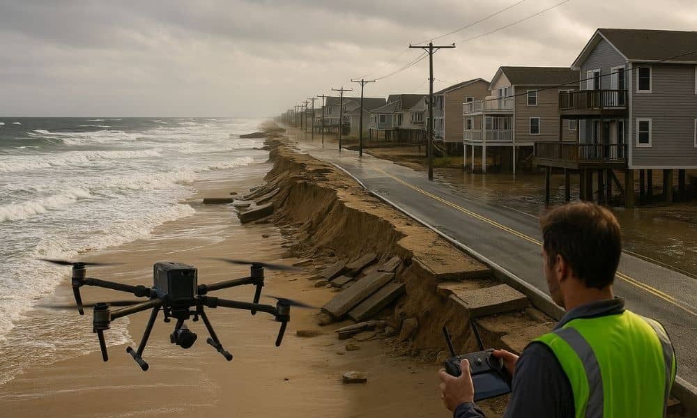
When the latest coastal storm hit York, Maine, it didn’t just bring rain and strong winds. It changed the coastline itself. Dunes washed away, roads flooded, and seawalls cracked from the pounding surf. For many homeowners, it felt like their neighborhood had shifted overnight. That’s when drone surveyors stepped in. These professionals use small flying drones to map the land from above, helping people understand what the storm damaged and how to fix it.
In a town like York, where homes, beaches, and businesses sit close to the ocean, this new kind of surveying has become more than a trend—it’s a tool for recovery.
When the Storm Changes Everything
If you live near Long Sands or Short Sands Beach, you know how fast the ocean can turn rough. The October nor’easter brought waves taller than a house and wind that tore through yards. When the tide finally went out, it left behind a new landscape. Sand dunes that had taken years to build up were gone in hours. Retaining walls were cracked, and some beach stairs looked like they had shifted off their foundations.
These changes don’t just look bad—they can affect property lines, flood ratings, and even home values. When the ground itself moves, homeowners need to know exactly where their land begins and ends. That’s what makes post-storm surveys so important. But sending people out to measure damaged or flooded areas by hand is slow and risky. That’s why more surveying companies now rely on drones.
The Rise of Drone Surveyors
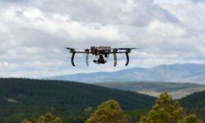
A few years ago, seeing a drone buzzing over the shoreline might have looked unusual. Now, it’s common. Drone surveyors use lightweight unmanned aerial vehicles to collect photos and measurements from the air. These images are then stitched together to create detailed 3D maps of the land.
Instead of walking every inch of a wet, uneven beach, a drone can fly over it in minutes and capture everything with incredible accuracy. This makes it much faster to assess storm damage and plan repairs. It also keeps surveyors safe—they don’t have to climb over unstable dunes or stand near crashing waves.
The data drones collect is extremely precise. It can show how much sand was lost, where the shoreline shifted, and how slopes or drainage patterns have changed. For coastal homeowners, that information is gold. It helps them file insurance claims, apply for permits, and make smart choices about rebuilding.
Why Drone Surveys Matter After a Storm
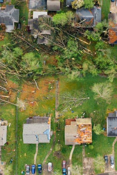
When a major storm hits, time becomes the most valuable resource. Every day that passes can add cost and stress. Roofers, contractors, and engineers all depend on accurate measurements before they can start work. Without clear data, rebuilding can stall for weeks.
Drone surveys speed everything up. With a quick flight, surveyors can create accurate maps that engineers and builders use right away. For example, if a seawall was damaged, a drone map can show exactly where the cracks or collapses are. The builder can then plan repairs without waiting for a full manual inspection.
The same data also helps insurance adjusters. They can compare “before” and “after” images to confirm what damage was caused by the storm. That makes the claims process smoother and faster.
And for towns like York, drone data supports long-term coastal planning. Local officials use it to track erosion patterns and predict which areas might flood next time. It’s a smarter, data-driven way to protect the community.
Linking Drone Surveys to Flood and Insurance Needs
Storms don’t only move sand—they can change the height of the land itself. Even a few inches of erosion can affect how a property is rated for flood risk. That’s where an elevation certificate comes in. It’s an official record that shows how high your building sits above the base flood level.
When major erosion happens, your old elevation certificate might no longer be accurate. That can lead to higher insurance rates or problems when selling or refinancing your home. By using drone surveys, licensed land surveyors can update these certificates quickly and accurately.
This is especially useful for homeowners along Ocean Avenue, Ridge Road, and Cape Neddick, where flood insurance rules are strict. Drones can map the new ground level, so property owners stay compliant with FEMA and local building codes.
Drone Surveys and Construction Recovery
After every storm, contractors and homeowners race to repair decks, driveways, and seawalls before winter. But reconstruction without accurate measurements can lead to big mistakes. Drones help prevent those problems.
For example, when a retaining wall collapses, a drone survey can capture its exact position and dimensions before cleanup begins. Builders can then design replacements that fit perfectly into the original footprint. The same goes for driveways or patios that are washed out. A precise aerial map ensures new work matches existing grades and slopes.
Contractors also use drone maps to guide construction staking—the process of marking where new structures will go. Because the images are detailed and measurable, crews can stake lines confidently, even on uneven or recently eroded ground.
Local Impact: How York Is Adapting
York’s combination of sandy beaches, rocky bluffs, and winding roads makes it a complex place to survey. Drones make it easier to handle those challenges. Along the shore, drone pilots can capture high-resolution images of steep dunes and stone seawalls that would be hard to reach safely. Inland, they can map flooded roads, culverts, and fields without stepping into muddy areas.
For the town’s planning and public works departments, these aerial views help with everything from drainage design to zoning reviews. Drone maps allow them to see patterns across the entire coastline instead of relying on a few sample points. That bigger picture leads to better decisions for future development and storm preparedness.
From Damage to Prevention
The latest storm was a reminder that the coastline is always changing. But it also showed how technology can make recovery faster and safer. Instead of waiting for outside reports or rough estimates, locals now have access to precise, same-day data.
Drone surveyors are also helping people prepare for the next event. By doing baseline surveys before storm season, homeowners can record exactly how their property looks under normal conditions. After a storm, comparing the two sets of data makes it much easier to prove what changed.
That’s a huge advantage for insurance claims and peace of mind. Knowing you have accurate “before and after” records saves hours of arguing later.
The Human Side of Drone Surveying
Some might see drones as just fancy gadgets, but in the hands of skilled drone surveyors, they’re powerful tools that protect people’s investments. These professionals aren’t just flying cameras—they’re trained in mapping, engineering, and data analysis. They understand airspace rules, weather limits, and local laws about coastal work.
When a drone team operates, they’re not just taking pictures for fun. They’re helping families document loss, guiding builders to rebuild safely, and supporting the town in planning smarter. That’s a real, measurable value.
Looking Ahead: Rebuilding Smarter
York will always face the challenge of balancing beauty with risk. Living by the ocean means accepting that nature will sometimes win a round. But now, the town also has tools to fight back with knowledge.
Every flight a drone takes adds another piece to York’s long-term coastal story. It helps engineers see patterns, helps insurance companies process claims fairly, and helps homeowners rebuild confidently.
Drone surveyors have become part of the recovery team—quietly flying overhead, turning photos into progress, and giving the information it needs to rebuild stronger after every storm.

