Why Every Homeowner in a Flood Zone Needs a FEMA Elevation Certificate
If your property is near the coast, a river, or low-lying land—like many homes in York, Maine—there’s a good chance you’ll hear the term FEMA elevation certificate when buying, selling, or renovating. But what is it, and why does it matter?
Simply put, this document plays a critical role in determining your flood insurance rates, building eligibility, and even property value.
Let’s unpack what an elevation certificate is, when you need one, and how it can save (or cost) you thousands of dollars.

What Is a FEMA Elevation Certificate?
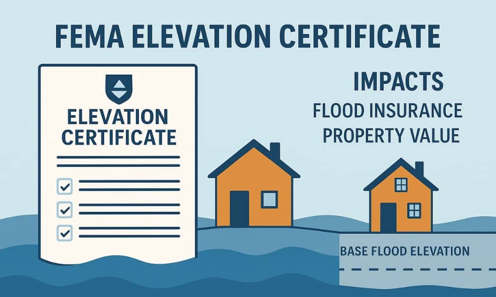
A FEMA elevation certificate is an official document that shows the elevation of your property relative to the base flood elevation (BFE). It’s issued by a licensed land surveyor, engineer, or architect and is used to assess your flood risk.
It includes details such as:
- Building location and footprint
- Elevation of the lowest floor
- Flood zone designation
- Foundation type
- Certification by a licensed professional
Why it matters:
FEMA and insurance companies use this data to determine your flood insurance premiums. The lower your property sits relative to the BFE, the higher the risk and cost.
When Is an Elevation Certificate Required?
You may need a FEMA elevation certificate in any of these situations:
🏠 Buying or selling property in a high-risk flood zone (Zone A or AE)
- Buyers may ask for the certificate before purchasing.
- Sellers can use it to prove lower flood risk and enhance property value.
🔨 Before starting renovations, additions, or new construction
- Local building departments often require it to approve building permits.
💧 When applying for flood insurance through the National Flood Insurance Program (NFIP)
- Especially important for determining accurate premium rates.
🏗️ After FEMA updates flood maps (FIRMs)
- If flood zone boundaries shift, a new certificate may be necessary.
How It Affects Flood Insurance Premiums
Flood insurance premiums can vary widely depending on your elevation. Without a certificate, insurance companies may assume the worst-case scenario, leading to inflated premiums.
With an elevation certificate:
- You get accurate flood risk data.
- Potential to lower your insurance premiums—often by hundreds or thousands annually.
- Avoid paying for unnecessary flood insurance if your actual risk is low.
Example:
A homeowner in coastal York paid $2,600/year in flood insurance. After submitting an elevation certificate showing the property sat well above BFE, the premium dropped to $950/year.
If you’re unsure where your property stands, consider reaching out to land surveying services in York for FEMA-compliant elevation certificates to get a clearer picture.
Who Can Complete a FEMA Elevation Certificate?
Only qualified professionals can prepare this document:
- Licensed land surveyors
- Registered professional engineers
- Certified architects
How Much Does a FEMA Elevation Certificate Cost?

In Maine, a FEMA elevation certificate typically costs between $500 and $800, depending on:
- Property location and size
- Complexity of the structure
- Existing records or surveys
Compared to potential insurance savings and risk reduction, it’s often well worth the investment.
FEMA Resources for Homeowners
- FEMA Elevation Certificate Instructions (FEMA.gov)
- Flood Map Service Center
- National Flood Insurance Program (NFIP)
Don’t Wait—Get an Elevation Certificate Before You Regret It
Whether you’re looking to protect your home, cut insurance costs, or start a new construction project in York, Maine, a FEMA elevation certificate is a small step that offers major peace of mind.
Knowing your flood risk—and having documentation to prove it—can help you make smarter, safer, and more affordable decisions about your property.
FAQs
Q1: Do all properties need a FEMA elevation certificate?
No. Only properties in Special Flood Hazard Areas (SFHAs) typically require one, but it’s useful in many other cases too.
Q2: How long is an elevation certificate valid?
There’s no formal expiration date, but new surveys may be required after structural changes or flood map updates.
Q3: What happens if I don’t get one?
You could face higher insurance premiums, delayed permits, or an inability to accurately prove your flood risk.
Q4: Can I transfer my elevation certificate to a new owner?
Yes—it’s tied to the structure, not the owner. This can be a helpful selling point.
Q5: Is the elevation certificate different from a topographic survey?
Yes. While both involve elevation, a topographic survey maps land features. A FEMA elevation certificate is focused on flood risk.
Q6: How do I know if I’m in a flood zone?
Use the FEMA Flood Map Tool or contact your local planning office.


