Boundary Survey: Avoid Costly Property Line Disputes

Property lines may look simple. Many people think fences, trees, or stone walls show where land begins and ends. However, land boundaries can be more complex. Recent news about the York–Kittery border issue shows how confusing boundaries can become when records are not clear. While that issue involved two towns, the same problem can happen […]
Erosion Took Your Yard—Get a Boundary Survey Now

When the waves get rough along York’s coastline, homeowners feel it right away. Seawalls crack, dunes wash away, and sandy backyards turn into cliffs overnight. After this season’s nor’easter, York’s beaches at Long Sands and Short Sands look completely different. The shoreline literally moved. And that raises a question few people think about until it’s […]
Why a Boundary Survey Matters Before You Build or Buy
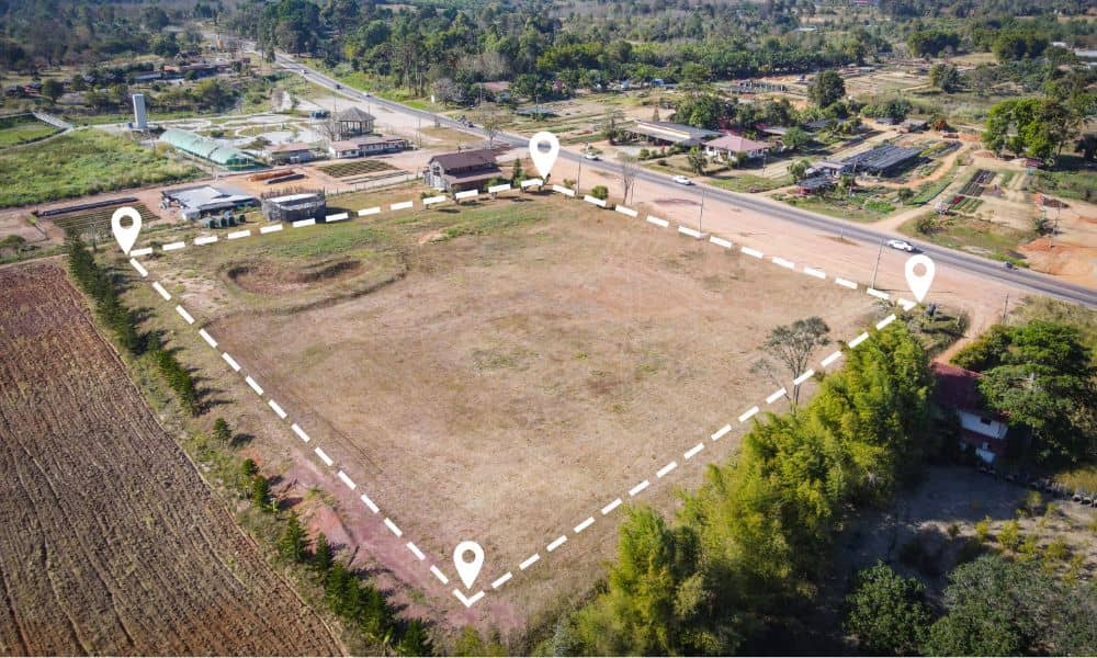
Thinking of Buying or Building in York, Maine? Here’s Why You Need a Boundary Survey Whether you’re buying a new home near the rocky coast of York or planning a custom build in a quiet cul-de-sac, there’s one essential step many people overlook: getting a boundary survey. It might not sound exciting, but skipping this […]