Boundary Survey: Avoid Costly Property Line Disputes

Property lines may look simple. Many people think fences, trees, or stone walls show where land begins and ends. However, land boundaries can be more complex. Recent news about the York–Kittery border issue shows how confusing boundaries can become when records are not clear. While that issue involved two towns, the same problem can happen […]
When to Call a Licensed Surveyor After Storm Damage
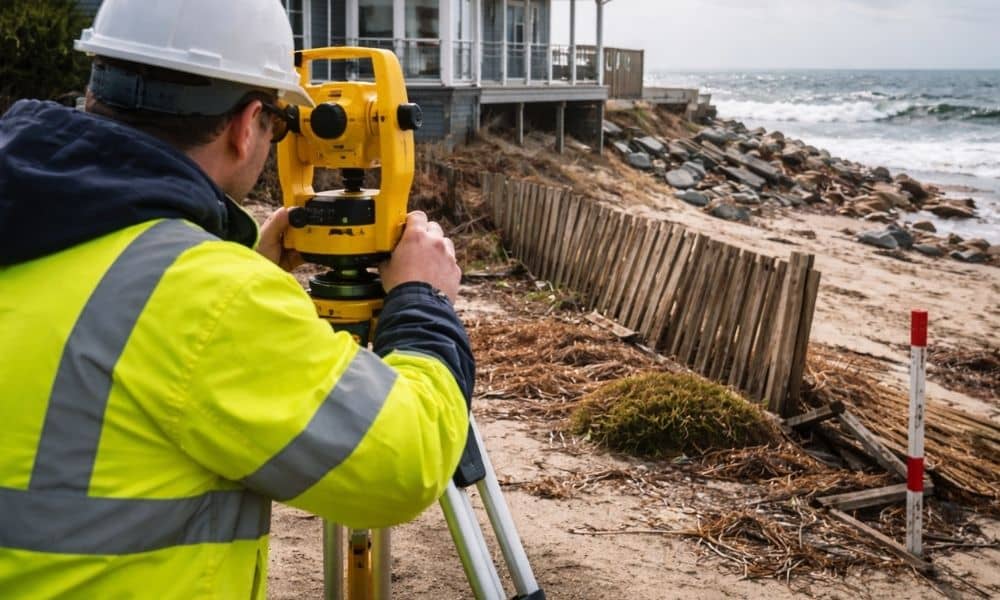
The morning after a nor’easter hits York, everything looks different. Snow piles up against seawalls. Fences lean. Dunes shift. Driveways crack. In some areas near the coast, water pushes sand and debris into yards that looked fine just days before. Naturally, once the storm clears, most homeowners focus on cleanup and repairs. However, there’s one […]
Land Surveying Is Evolving with Industry Growth

This week, a Maine engineering and surveying firm announced a new acquisition in Southern Maine. At first, that may sound like industry news that does not affect you. However, it shows something bigger. Demand for land surveying in Southern Maine keeps growing — and that growth affects property owners in York and nearby towns. So […]