Topographic Survey: Why Airborne Mapping Matters

If you have looked up lately and seen low-flying aircraft over parts of Maine, you are not imagining it. State and federal teams have started new airborne mapping flights across the region. These flights collect updated elevation data using LiDAR and other sensors. While that may sound technical, it connects directly to something many property […]
Construction Survey: Stop Costly Utility Locate Mistakes
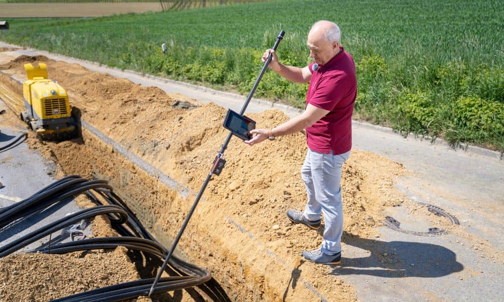
If you talk to surveyors and field crews lately, you’ll hear the same complaint again and again: utility locate mistakes keep causing jobsite problems. Paint marks don’t match reality. Map screenshots replace field checks. Old records get treated like the exact truth. Then digging starts — and suddenly everything stops. As a result, projects stall, […]
When You Need a Boundary Line Survey in Shoreland Zones

Living near the coast gives you amazing views, fresh ocean air, and a peaceful setting. However, it also comes with special building rules that many homeowners don’t expect. These rules can affect even small projects. Because of this, a boundary line survey often becomes a key step before you build, repair, or upgrade anything near […]