
If you have looked up lately and seen low-flying aircraft over parts of Maine, you are not imagining it. State and federal teams have started new airborne mapping flights across the region. These flights collect updated elevation data using LiDAR and other sensors. While that may sound technical, it connects directly to something many property owners need: a topographic survey.
So what does this new mapping effort really mean? And how does it affect homeowners, builders, and developers in places like York?
Maine’s Airborne Mapping Initiative Explained
Recently, aircraft began flying over sections of Maine to collect updated terrain data. These planes send laser pulses to the ground. The system measures how long it takes for the signals to return. From that data, experts build digital models that show the shape of the land.
Because of this effort, Maine now has stronger large-scale elevation data than before. Engineers and planners can see hills, slopes, and land patterns more clearly. This helps with long-term planning across the state.
However, this mapping does not replace a topographic survey. Instead, it helps surveyors prepare better before working on your property.
Do You Still Need a Topographic Survey?
You might ask, “If the state already mapped the land, why do I still need a survey?”
That makes sense.
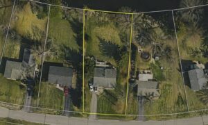
Airborne mapping shows the general shape of large areas. But construction projects need much more detail. Builders need exact elevation points. Engineers need clear contour lines. Town reviewers expect certified measurements taken on the actual site.
In simple terms, statewide mapping gives a big picture. A topographic survey gives exact details for your specific lot.
So if you plan to build a home, add a driveway, design drainage, or prepare a site plan, you still need a licensed land surveyor to measure your land directly.
How Airborne Mapping Improves the Modern Topographic Survey
Even though airborne mapping does not replace surveys, it changes how surveyors work.
First, surveyors can review statewide LiDAR data before they visit your property. They study slopes and land features ahead of time. Because of this, they arrive prepared. Fieldwork becomes more focused and efficient.
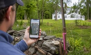
Next, many survey teams use drones. They fly drones over the site to capture clear images and surface data. Then they confirm elevations using GPS and other ground tools. This combined approach creates a stronger and more detailed topographic survey.
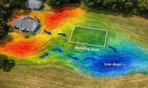
In addition, surveyors now provide digital 3D models. Instead of just paper maps, engineers can view terrain in a computer model. They can study slopes and test grading ideas before construction begins. As a result, design teams can spot issues earlier.
Why Accuracy Expectations Are Rising in Maine
As mapping tools improve, expectations also rise.
Engineers want tighter elevation detail. Developers want clear grading plans before moving soil. Investors often review terrain models during early planning.
Since Maine continues to grow, demand for reliable land data keeps increasing. New homes and small developments require clear terrain information. Because of that, the topographic survey plays an even bigger role in planning.
Also, improved statewide mapping sets a higher standard. When professionals see clearer terrain data, they expect site surveys to match that level of detail.
Public Data vs. Certified Survey Data
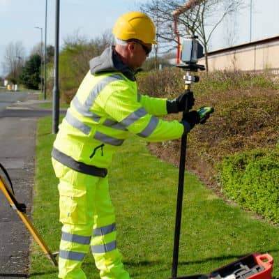
Even though Maine’s airborne initiative collects useful data, it does not provide certified site measurements.
Public data shows general land patterns. It helps surveyors prepare. However, it does not confirm the exact elevation where your house will sit. It does not provide construction benchmarks. It does not carry a licensed surveyor’s certification.
A licensed land surveyor completes a topographic survey by taking measurements directly on your property. That certification protects property owners, engineers, and builders. It also ensures accuracy if questions come up later.
So public mapping helps with planning, but certified field measurements remain necessary.
What This Means for Property Owners
If you own land in York or nearby towns, this technology can benefit you.
First, surveyors can prepare better before coming to your property. That preparation can shorten turnaround time. Next, digital models help your design team understand slopes more clearly. Because of that, projects often move forward with fewer surprises.
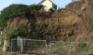
In addition, improved terrain data helps builders study grading and layout earlier in the process. For example, they can see how elevation changes may affect a driveway or foundation.
Still, technology does not replace professional skill. It supports it.
The Future of the Topographic Survey in Maine
The topographic survey will keep evolving.
Survey teams will combine airborne LiDAR, drone mapping, and ground measurements. Digital terrain models will become standard. Software will allow engineers to test grading plans before construction starts.
As these tools improve, property owners will see clearer plans and better visualization. At the same time, surveyors will continue to rely on careful ground measurements for accuracy.
Technology may change how surveys look, but precision will always start on the ground.
Final Thoughts
Maine’s new airborne mapping initiative improves how the state understands its terrain. It supports planning and helps surveyors prepare more efficiently.
However, if you plan to build or develop, you still need a licensed expert to complete a site-specific topographic survey.
Airborne mapping gives the big picture. A certified survey gives the exact details your project needs. And when construction decisions depend on slope and elevation, those details matter.