Thinking of Buying or Building in York, Maine? Here’s Why You Need a Boundary Survey
Whether you’re buying a new home near the rocky coast of York or planning a custom build in a quiet cul-de-sac, there’s one essential step many people overlook: getting a boundary survey. It might not sound exciting, but skipping this survey can lead to major headaches—like legal disputes with neighbors or costly construction delays.

What Is a Boundary Survey and Why Does It Matter in York, Maine?
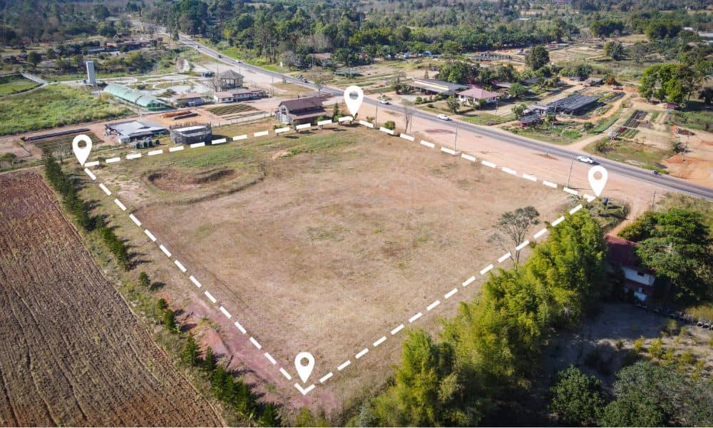
A boundary survey is a professional assessment done by a licensed land surveyor to determine the exact property lines of a parcel of land. In a town like York—where historical plots, stone walls, and evolving land use laws are common—accurate boundaries are more important than ever.
Here’s what a boundary survey typically includes:
- Marking corners and property lines with stakes or monuments
- Reviewing land deeds, plats, and municipal records
- Mapping out the legal description of the property
- Identifying encroachments, easements, or right-of-ways
When Should You Get a Boundary Survey in York?
You don’t need to wait for a problem to pop up. In fact, getting a boundary survey before major decisions can save time, money, and neighborly goodwill.
Ideal times to get a boundary survey:
- Before buying a home or land – Know what you’re paying for.
- Before building a fence, shed, or home addition – Avoid encroaching on someone else’s land.
- When resolving a property line dispute – Get legal clarity backed by professional data.
- For subdividing or developing land – Essential for permits and planning board approvals.
- Prior to selling property – Ensure accurate listings and prevent post-sale disputes.
Real-Life Example: A York Homeowner’s Costly Oversight
A homeowner in York Village planned to add a garage extension. Confident in where their property ended (based on an old plot plan), they skipped the survey. Months later, a neighbor filed a complaint—part of the new structure extended onto shared land. The issue led to a legal dispute, forced redesign, and thousands in additional costs.
A $1,000 survey could have prevented a $20,000 mistake.
How a Boundary Survey Helps Avoid Legal Disputes in York
Property line disagreements are more common than you might think—especially in coastal towns like York, where plots often date back over a century.
A boundary survey offers:
- Peace of mind – Know your rights and where your land begins and ends.
- Legal documentation – Survey plans can be submitted in court, if needed.
- Neighborly relationships – Prevent conflicts over fences, trees, or structures.
Understanding Survey Costs in York, Maine
Survey prices vary based on the property size, terrain, and complexity. In general, a boundary survey in York ranges between $600 to $1,500.
Factors that affect cost:
- Lot size and shape
- Research required (especially for older deeds)
- Accessibility and terrain
- Whether prior surveys exist
How to Choose a Surveyor in York You Can Trust
Not all surveyors are created equal. Look for someone who is:
- Licensed in Maine
- Experienced with York zoning and land history
- Insured and bonded
- Transparent about costs and timelines
Whether you’re dealing with a historic property or preparing for new construction, choosing the right land surveying services in York can make all the difference. A knowledgeable local surveyor understands the nuances of coastal zoning, variable terrain, and legacy property boundaries common throughout the area.
Protect Your Investment with a Boundary Survey in York
From coastal cottages to woodland lots, property in York, Maine is valuable—and sometimes complicated. A boundary survey isn’t just a technical step; it’s a smart investment that provides legal protection, accurate records, and peace of mind.
Whether you’re buying land, settling a dispute, or planning your dream home, take this simple but powerful step: Know your boundaries.
FAQs About Boundary Surveys in York
Q1: Do I need a boundary survey if there’s already a fence on my property?
A fence doesn’t guarantee accuracy. Many are built based on guesswork or outdated info.
Q2: Can I use an old survey from 20 years ago?
Possibly—but it’s risky. Land changes over time, and town records or zoning laws may have shifted.
Q3: How long does a survey take?
Most boundary surveys in York can be completed within 1-3 weeks, depending on complexity.
Q4: Who pays for the boundary survey—the buyer or seller?
It depends on the agreement. Often, the buyer pays during a real estate transaction.
Q5: Can a surveyor resolve a property line dispute legally?
They can provide evidence, but legal resolution usually requires court involvement.
Q6: Is a boundary survey required by the Town of York for building permits?
Not always, but many projects (like additions or subdivisions) require one for approval.


