When to Call a Licensed Surveyor After Storm Damage
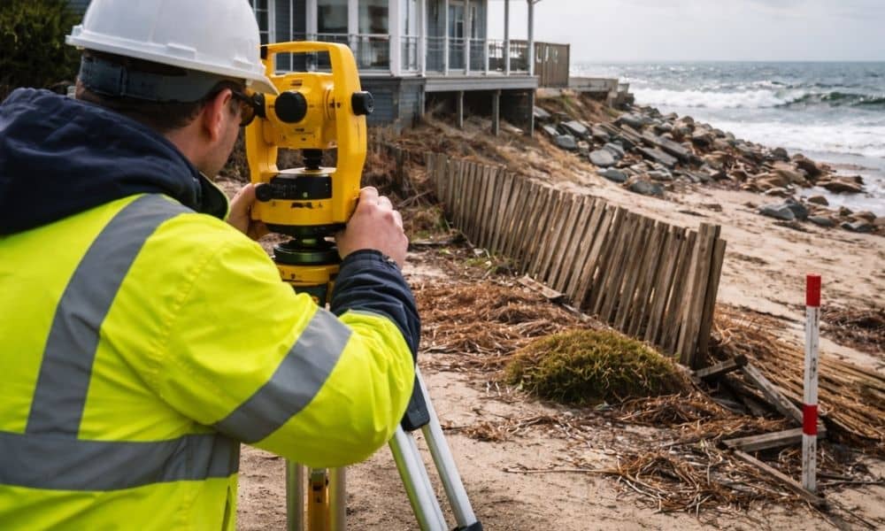
The morning after a nor’easter hits York, everything looks different. Snow piles up against seawalls. Fences lean. Dunes shift. Driveways crack. In some areas near the coast, water pushes sand and debris into yards that looked fine just days before. Naturally, once the storm clears, most homeowners focus on cleanup and repairs. However, there’s one […]
Land Surveying Is Evolving with Industry Growth

This week, a Maine engineering and surveying firm announced a new acquisition in Southern Maine. At first, that may sound like industry news that does not affect you. However, it shows something bigger. Demand for land surveying in Southern Maine keeps growing — and that growth affects property owners in York and nearby towns. So […]
Topographic Survey: Why Airborne Mapping Matters

If you have looked up lately and seen low-flying aircraft over parts of Maine, you are not imagining it. State and federal teams have started new airborne mapping flights across the region. These flights collect updated elevation data using LiDAR and other sensors. While that may sound technical, it connects directly to something many property […]