Welcome to ALTA Survey Maine

Your Final Stop for Your ALTA Survey Needs!                              Contact us today for a free quote!

This site is intended to provide you with information on ALTA Surveying in Maine. If you’re looking for a Maine Land Surveyor, you’ve come to the right place. If you’d rather talk to someone about your land surveying needs, please call our toll-free number at (888) 808-9783 today. For more information, please continue to read.

ALTA Survey Maine

Land Surveyors are professionals who make precise measurements to determine the size and boundaries of a piece of real estate.  While this is a simplistic definition, boundary surveying is one of the most common types of surveying related to home and land owners. If you fall into the following categories, please click on the appropriate link for more information on that subject:

ALTA Survey Maine services:

    1. I need to know where my property corners or property lines are. (Boundary Survey)
    2. I have a loan closing or re-finance coming up on my commercial property. (ALTA Survey)
    3. I need a map of my property with contour lines to show elevation differences for my architect or engineer. (Topo Survey – ALTA Survey plus Table A Item 5.)
    4. I’ve just been told I’m in a flood zone or I’ve been told I need an elevation certificate in order to obtain flood insurance or prove I don’t need it. (Flood Survey)
    5. I’m purchasing a lot/property for a commercial use. (ALTA Survey – Item 5 and/or Item 11b may also need to be discussed.)
    6. I’m purchasing a larger tract of land, acreage, that hasn’t been subdivided in the past. (Boundary Survey)
author avatar
Surveyor

More Posts

Licensed land surveyor performing an elevation survey at a residential property while the homeowner observes the process.
land surveying
Surveyor

Elevation Survey: Prove Your Property’s True Flood Risk

Buying a home near the coast sounds dreamy—until the flood maps start disagreeing. Many buyers are discovering that their listings show “high flood risk” on Flood Factor, even though FEMA maps place their property in a low-risk zone. That mix-up can freeze a loan, raise insurance costs, or even delay

Read More »
Eroded beachfront showing exposed roots and buildings near the shore, highlighting the need for a boundary survey after storm damage.
boundary surveying
Surveyor

Erosion Took Your Yard—Get a Boundary Survey Now

When the waves get rough along York’s coastline, homeowners feel it right away. Seawalls crack, dunes wash away, and sandy backyards turn into cliffs overnight. After this season’s nor’easter, York’s beaches at Long Sands and Short Sands look completely different. The shoreline literally moved. And that raises a question few

Read More »
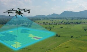
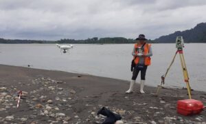
A drone surveyor mapping coastal erosion and storm damage along a flooded shoreline to support post-storm recovery.
land surveyor
Surveyor

How Drone Surveyors Aid Post-Storm Recovery

When the latest coastal storm hit York, Maine, it didn’t just bring rain and strong winds. It changed the coastline itself. Dunes washed away, roads flooded, and seawalls cracked from the pounding surf. For many homeowners, it felt like their neighborhood had shifted overnight. That’s when drone surveyors stepped in.

Read More »
Coastal homes overlooking the ocean showing flood risk areas where an elevation certificate may be required for mortgage closings
flood damage
Surveyor

Elevation Certificate Delays Could Stall Mortgage Closings

Buying or selling a home should be exciting, but right now there’s a new wrinkle making things stressful in York. If you live near the coast, the York River, or low-lying land, chances are you’ve heard about an elevation certificate. This surveyor-prepared document shows how high your home sits compared

Read More »
Waves crashing over a seawall during a coastal storm highlighting the need for a flood elevation survey for nearby homes
flood damage
Surveyor

Why Every Coastal Home Needs a Flood Elevation Survey

When a video of a house collapsing into the Atlantic Ocean in North Carolina went viral in late September, it made homeowners everywhere stop and think. The footage from Buxton on the Outer Banks showed a beachfront home crumbling into the surf during a coastal storm. It was dramatic, shocking,

Read More »
High surf crashing against rocks near coastal homes, showing storm impacts that can affect FEMA elevation certificate requirements
flood damage
Surveyor

How Coastal Storms Impact Your Elevation Certificate

When a coastal storm pushes high surf into York, it does more than rattle windows and soak the beach. It can also shift dunes, scrape away sand, and change the very ground your home stands on. If you live near Long Sands, Short Sands, or Cape Neddick, these changes can

Read More »